
By Lewis Fried
For those interested in urban planning, City on a Grid ought to be read. For those studying the growth of Manhattan, this book isindispensable. Gerard Koeppel raises large questions that envelop smaller ones: inquiries into the values of a particular city plan (in fact, one can infer any metropolitan design), and the history of the plan set in concrete. In the case of New York City, the rectilinear grid is almost the alpha and omega of urban design that did not happen by chance but was molded by a commission in 1807. The commission, once authorized, set the stage for the grid, “ordained” in 1811. The grid might seem to have sprung full-blown from a geometry textbook, but this plan had to take into consideration the shape of Manhattan and its topography, the land of property holders, the competency of surveyors, decisions about traffic flow, ease of movement, aesthetics, and to cut short a list of numerous factors, the personalities of those in charge of street planning. As a result, the story of the grid involves an idea of what a city is: who made it, what amenities and necessities (or lack of such) a gridded metropolis offers to its inhabitants, and possibilities for future planning. It strikes me that Koeppel accounts—and well—for every detail, both obscure and open to public view.
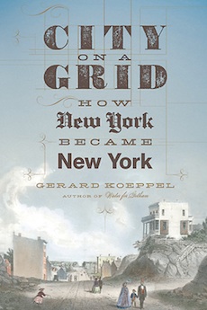
Introducing the book, Koeppel offers us a photograph capturing the grid’s imposition on the island. Taken by Peter Baab in the winter of 1882-1883, it exposes “redundant geography, the thickening assemblage of rectangular shapes in different planes: the blocks of streets, the block-shaped new buildings, the rectangular building walls.” Yet what is often cropped out is equally revealing: open, vacant land traversed by two footpaths. In its entirety, the photograph presents the walkway made by human choice prior to the grid, and the grid itself, which erases nature. The walking path exposed the quickest way to a destination. The grid, an engineered geography, determines how people and traffic must move. The former is “organic,” exhibiting “the free, mystic movements” through the remains of nature. The planned grid, in high tension with the “organic,” offers us the “autocratic, abstract, magical geometrics of the planned city.” Decades earlier, Paul Goodman, America’s own grand and innovative social thinker (one whose own city plans in various essays and in Communitas, written in conjunction with his brother, the architect Percival Goodman), called for a new genre of letters, one that City on a Grid will augment—the urban pastoral, celebrating the infrastructure of the city such as its methods of transportation and building while reminding us of its dependency on the majesty of nature: the “lordly Hudson.”
Koeppel, with an overarching authority, describes almost section by section, and in many cases block by block, how this coexistence became an almost totalizing unity, a victory for the geometer’s metropolis. Koeppel points to the date when this triumph (or tragedy) took place. Asking “when did the 1807 Commissioners, formerly titled the ‘Commissioners of streets and roads in the City of New York,” become the ‘grid Commissioners.’” At what point in time was “the single, rectilinear grid” agreed upon? The answer: around November 29, 1810. The date is important not because of its being sunk within the past but rather because it showed how the city is controlled by its past.
The street grid challenged topography; it cut through and graded and erased what stood in its way. However, northern Manhattan, with a portion of land counterpoising the mechanical offered—and, to an extent still does—an opportunity to see how shoreline, tree-land and street could comport, making the city open for enjoyment and small wandering.
The grid met with criticism: no curvilinear streets? No diagonals? More variable blocks? Better balancing between north-south, and east-west roads? More streets? More avenues? Yet the island has its grand jewel: Central Park. A project undertaken by F.L. Olmstead and Calvert Vaux, the Park was framed by the grid, which Koeppel calls its “prison.” Its “natural sinuosities,” verdure, and lake, show how even a planned park offers—and delivers—a setting for spontaneity, harmonizing the private with the public.
Koeppel explains that the grid may not be the only or even last word in the island’s planning. Although people have become used to the deification of the rectangle, habitual ways of seeing and technology change; for example, “curves may in due course become more cheap and more convenient,” he explains. At that future point, the gridded pattern will be a “constraint, not a cheap convenience.” In other words, there is much to look forward, and also much now at which to marvel.
Lewis Fried (ΦBK, Queen’s College, CUNY, 1964) is Professor of English Emeritus at Kent State University and a resident member of the Nu of Ohio chapter of Phi Beta Kappa.